The Harappan (Indus) Civilisation
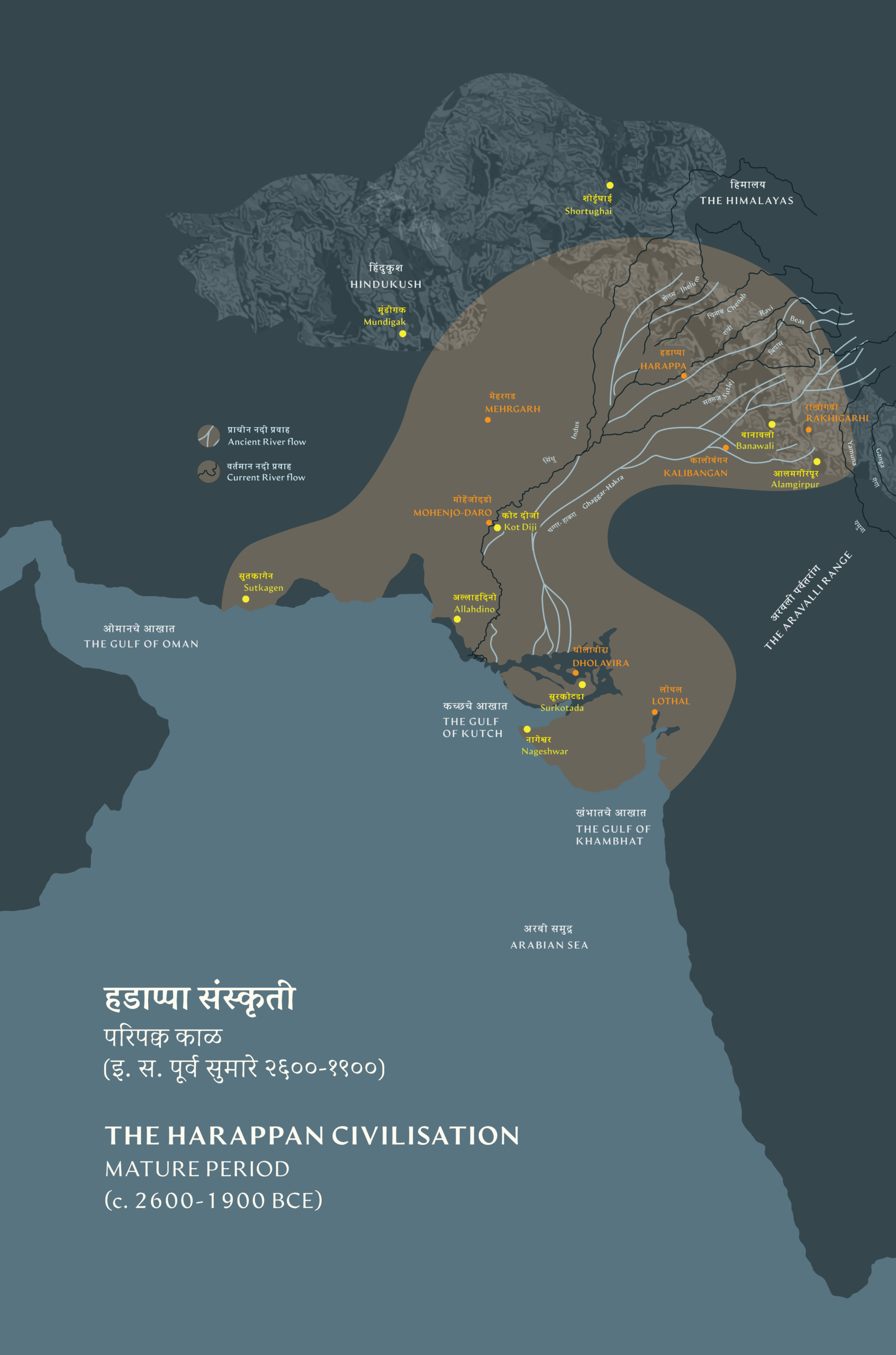
The ancient Harappan Civilisation developed nearly five thousand years ago along the rivers, Indus (Sindhu) and Ghaggar-Hakra, and the coast of the Arabian Sea. It was the largest among other Bronze Age cultures of Mesopotamia, Egypt, and later, China. Though the script-like signs of the Harappans —inscribed on steatite seals and pottery remain undeciphered, material remains shown in this gallery from the Mature Harappan Period (2600–1900 BCE), reveal their skill in agriculture, crafts, metallurgy, and trade. Major urban centres or the first cities — Harappa, Mohenjo-daro, Rakhigarhi, Kalibangan, Lothal, and Dholavira —which evolved from village settlements, exhibit town planning, advanced sanitation systems, a high level of standardisation and remarkable water management technology. Supported by a network of smaller towns and villages that supplied food and raw materials to large urban centres, the well-organised Harappans were possibly a peaceful, innovative and trade-focused society. Long-distance trade networks, both through sea and land, extended to the Arabian coast, Mesopotamia and Central Asia. This gallery celebrates the enduring legacy of the Harappan Civilisation — many aspects of which continue to shape South Asian life today.
This civilisation was first sighted through its cities, at Harappa and Mohenjo-daro (in Pakistan, c. 2600 -2200 BCE), which were excavated in the early 1920s by the Archaeological Survey of India. The first excavations here were led by the Survey’s prominent superintending archaeologists, Daya Ram Sahni and Rakhal Das Banerji, respectively. By the mid, 1920s this civilisation was correctly gauged as being contemporary with the Bronze Age Sumerian civilisation of Ancient Mesopotamia, which was also being excavated at the time from sites such as Susa, Kish, Lagash and, subsequently, Ur, which flanked two river systems, the Tigris and Euphrates.
Over the last century, numerous excavations in India and Pakistan have established a chronology of the Harappan Civilisation that spans from the Early Food Producing era, dated to 6500 BCE, to the Late Indus Civilisation Phase, which ended around 1800 BCE. Archaeologists have traced several stages of development of the culture, which cannot be strictly defined as ‘one tradition’ – progressing from scattered villages to well-established urban cities and towns. It is also known to occupy a vast geographical area of nearly 680,000 square Kilometres, the largest of all the Bronze Age civilisations. Today, archaeologists abstain from calling the Harappan sites part of the Indus ‘valley’ alone, as the footprint has expanded widely. It is spread from Gujarat in the south to parts of Baluchistan, and possibly Kashmir in the north, and from areas of Seistan (Iran) in the West to those of Uttar Pradesh (India) in the East.
From the 1960s, Indian archaeologists have increasingly referred to this Civilisation as the Harappan Civilisation, following the precedent of naming an archaeological phenomenon after its first excavated site. Today, school textbooks of history in India use the term Sindhu-Sarasvati Sabhyata. The Sumerians knew them as the inhabitants of Meluhha and cuneiform tablets, prominently some from the time of king Sargon of Akkad (2334-2279 BCE) carry this name.
Climate and cultural diversity
The vast area over which the Civilisation was spread had different weather systems. The winter cyclonic system prevailed in the western highlands, where Harappa and Mohenjo-daro are located. The present-day Gujarat and Kutch regions, where cities such as Dholavira and Lothal are located, were governed by the summer monsoon system. As a result, some rivers and water bodies filled up due to glacier melting, while others received water through the ‘Two-rain system’ of summer and winter rainfall.
The most important part of this varying geography was the fact that different regions produced different crops such as wheat, barley, rice and millets. If one Harappan region was poor in some resources, such as copper or tin (which indeed was the case, as the Indian subcontinent did not have adequate reserves of copper or tin), they could get it from other surrounding areas, and sometimes even from far-flung regions.
Jonathan Mark Kenoyer notes that this juxtaposition of mountains, river plains and coasts provided a unique pattern of seasonally available resources and raw materials that was crucial for the development of an urban civilisation, quite different from the situation in either Mesopotamia or Egypt. This variable geography facilitated trade and exchange networks, which was significant for the development of the urban civilisation.
The surviving ramparts of towns and cities help us understand how ecology and urbanisation went hand in hand to create sustainable systems that carefully integrated weather patterns and climatic conditions into city-building and living.
Dholavira - a typical Harappan site
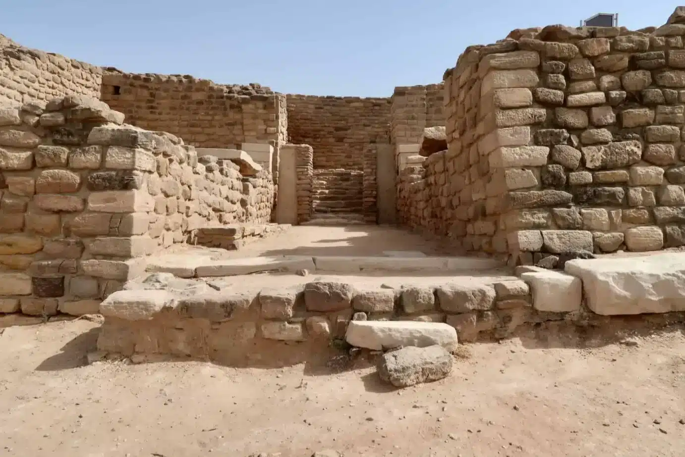
Located in the middle of a natural salt marsh (the Great Rann of Kutch) in Gujarat, Dholavira is one of the best-preserved Harappan sites in India. It has survived well as it was substantially built with stone. The climate here is harsh, and it is still a great mystery why people chose to inhabit this terrain from around 3000 to 1500 BCE.
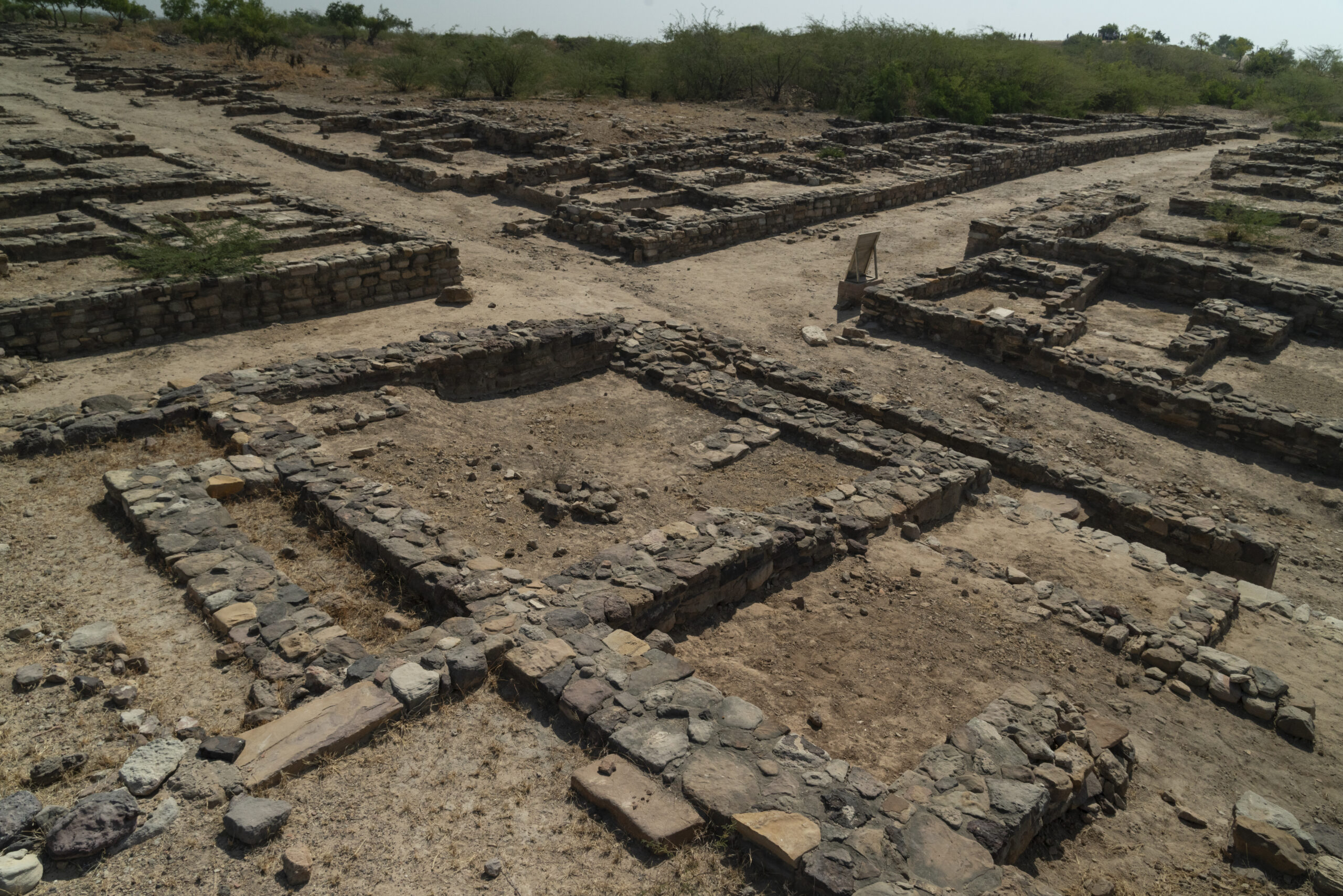
There were multiple fortifications of stone segregating different parts of the city as well as well-planned streets and houses of varying sizes, probably reflecting social order. This urban centre was watered by two seasonal streams that filled up during monsoons. Sophisticated water management, as seen in the reservoirs and drainage systems of Dholavira, demonstrates the Harappans’ genius.
Bead-making workshops and artefacts of various kinds, such as copper, shell, stone, semi-precious gems, terracotta, gold, ivory, and other materials, have been excavated here, exhibiting the culture’s artistic and technological advancements. Surrounded by rich mineral deposits, the Arabian Sea to its west, and the Indian hinterland to its east, was Dholavira – a strategic location for trade?
Trade and agricultural links with smaller settlements such as Nageshwar, Bagasara, and Surkotada (all in Gujarat), made major cities like Dholavira part of a wider network of towns and villages in the culture. In this way, the islands of Kutch, and the regions of Saurashtra and mainland Gujarat were connected for trade and exchange.
The North and South gates in Dholavira were the entry points into the citadel, offering a vantage over the sprawling cityscape. Built with sandstone and limestone, commonly available in the area, the gates show how meticulously stone was cut and set to build walls and fortifications. These fortifications were often tapered towards the top to grant stability.
How the Harappan cities were built
The cities of Dholavira (in Kutch, Gujarat), Rakhigarhi (in Haryana), Kalibangan (in Rajasthan), and Lothal (in Gujarat) in India, as well as Harappa, Mohenjo-daro, Chanhu-daro, Allahdino, and Ganweriwala (in Pakistan), among several others, are now being excavated incrementally. They help us understand the foundations of civilisation in South Asia. It is difficult to determine whether all the Harappan sites emerged simultaneously or in sequence, although the dates established for Harappa and Mohenjo-daro are earlier than those of Dholavira.
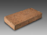
Often built along north-south or east-west directions, many of the Harappan cities were divided into areas separated by walls. These included citadels, different types of residences for the elite, merchant and working class, public spaces, baths, and marketplaces. Buildings were usually constructed using standard-sized bricks (in the ratio 1:2:4) and, on one occasion, in Dholavira, in stone. Individual houses had neatly segregated rooms, baths, and storage units, much like modern-day apartments and their amenities. Street networks were carefully designed — main roads connected the urban centre and public buildings to residential quarters and were broad enough to allow bullock carts to drive through.In contrast, narrower pedestrian streets linked individual houses that often faced away from the main streets, providing privacy.
Hygiene was a high priority. Each house was equipped with a bathroom and a well-developed internal drainage system. Perforated pots were placed between internal and external drains to trap solid waste.
Water management was a crucial feature of all Harappan cities, as many of them flourished in challenging regions, located variously in desert plains, arid sea coasts, and floodplains of rivers that constantly changed course. It is possible that over a period of time, people observed flood and seasonal rainfall patterns, which informed the design of their sophisticated water management systems. Many cities incorporated drainage networks, systems of water storage, and stormwater pipes into their urban design (to prevent flooding). The construction of numerous sunken wells, artificial tanks, water reservoirs, and lakes ensured an abundant water supply for the population.
Waterways, rivers, streams, and the sea were used for transportation, and the Harappans likely possessed excellent boat and ship-making skills, much like the people of Mesopotamia and Egypt, which supported a vast network of trade between Meluhha (likely the Harappan regions), Dilmun and Sumer.
How the Harappan cities were fed
The diverse landscapes in which Harappan cities and towns emerged also reflect the diverse occupations of the Harappans, who practised farming, herding, hunting, and fishing.
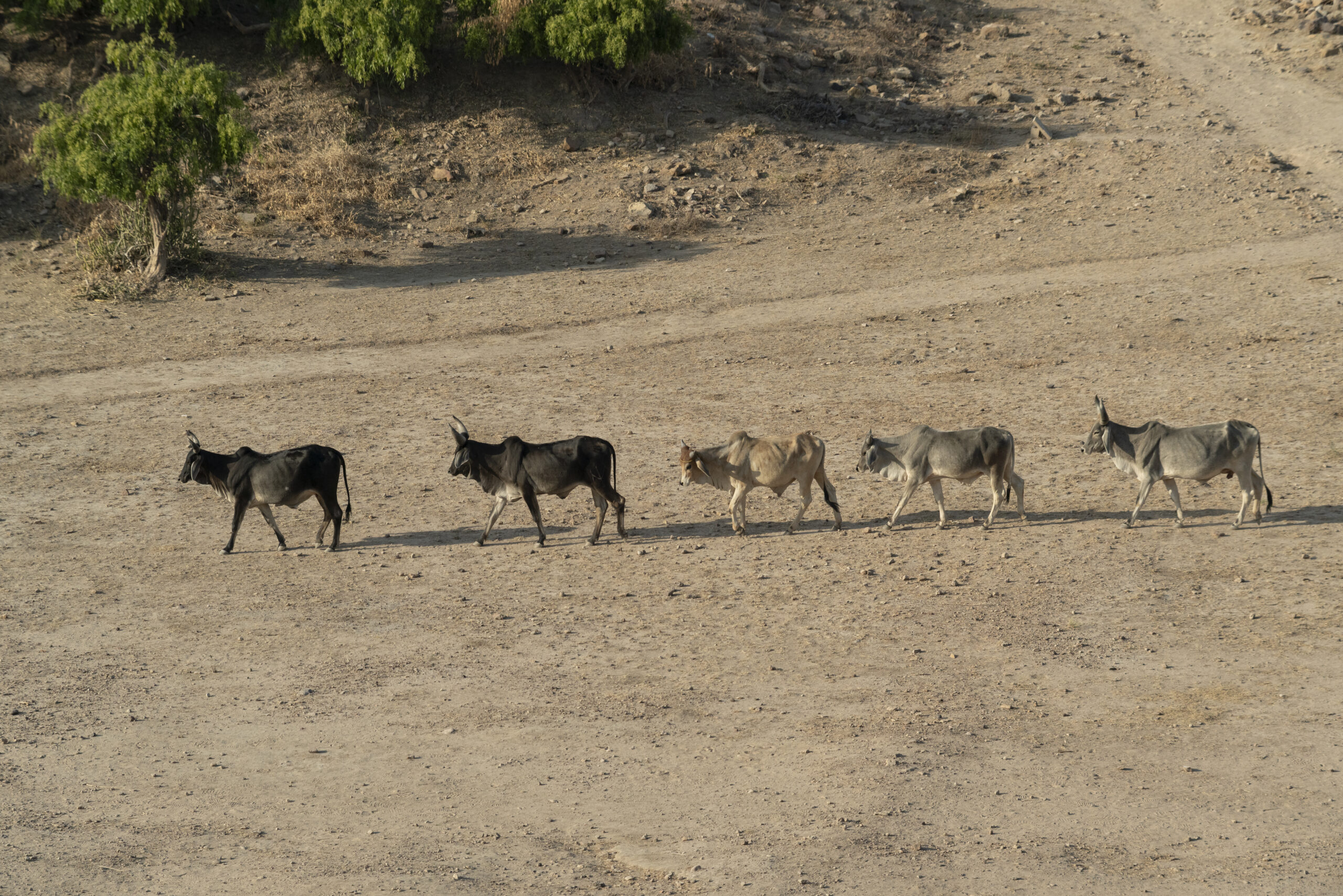
Over several years of experimentation, the Harappans would have learnt seasonal farming using the same piece of land for multiple crops and crop cycles—a practice common in India today. Irrigation with floodwater carrying rich silt, seasonal monsoons, and carefully constructed canals, wells, reservoirs, and step-wells ensured rich harvests. Cattle – bulls, cows and buffaloes were domesticated widely and may have been their most important source of wealth too. Evidence of domesticated goats, and sheep have been reported from almost all the Harappan sites. From the number of bones of goats with many instances of chopping marks and charring signs, it seems that they formed an important component of the Harappan food economy and people possibly supplemented their diet with meat and milk derived from these animals.
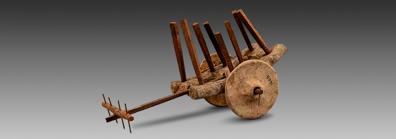
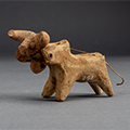
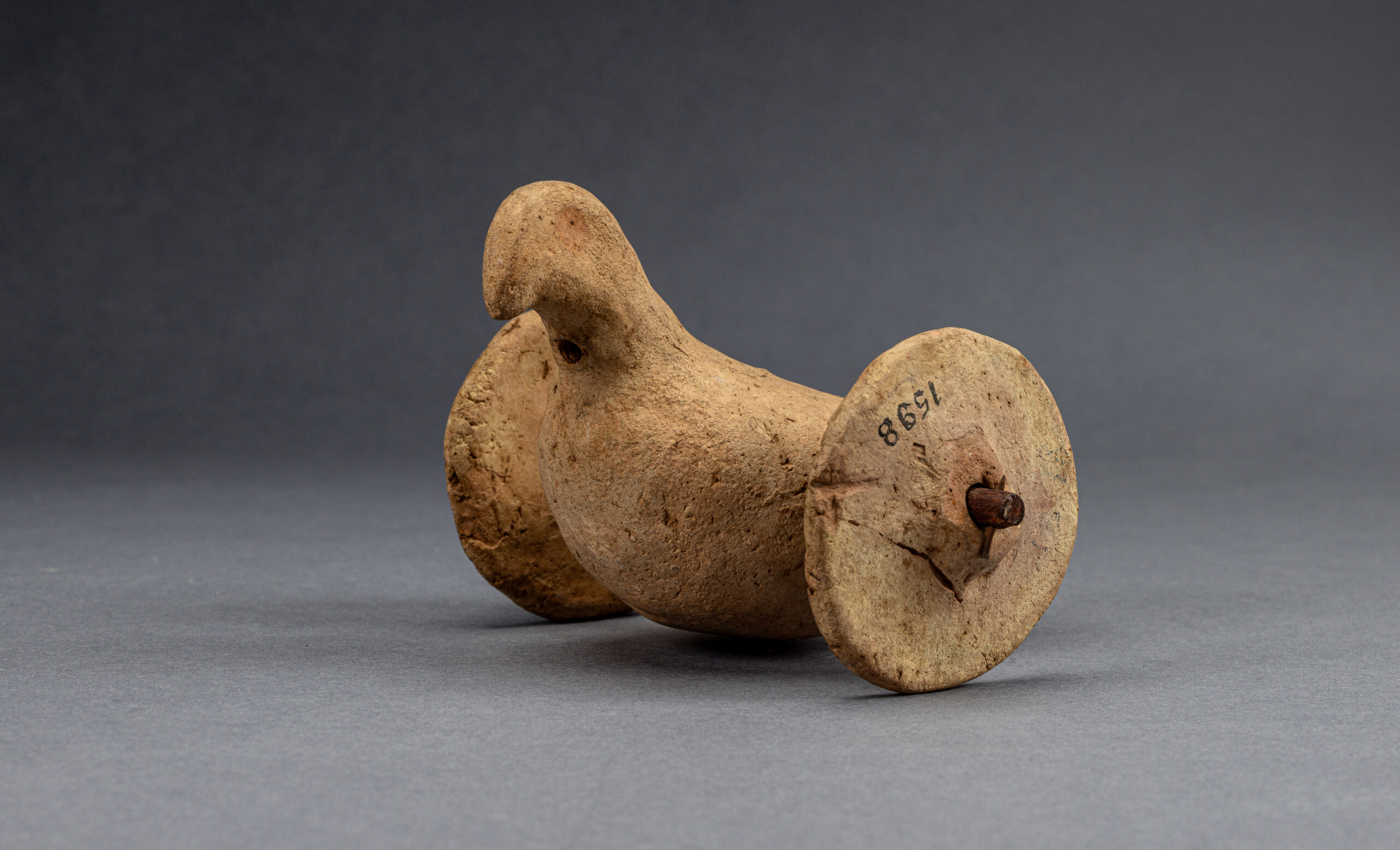
Pulled by one or two oxen, carts were common in the cities and villages. They were used for moving crop surplus, people and other heavy goods. One such miniature cart model from Mohenjo-daro in the CSMVS collection, dated to around 2600-1900 BCE shows wheels without spokes. Such carts were heavy, and slow-moving, but ideal for short-distance travel. Bulls were significant and appear frequently in seals, as miniature figurines and on pottery, suggesting their economic and ritual value. They were also associated with strength, leadership and fertility, and in particular, the Zebu Bull with large horns and a humped back was likely a symbol for powerful merchant clans.
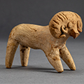
Archaeobotanical studies (of carbonised grains and their remains) at various sites reveal that wheat, barley, peas, lentils, chickpeas, and linseed were common winter crops; melons, gourds, dates, nuts, walnut, fenugreek, and cloves were grown in dry summers. During the monsoons, rice, millets, sesame, mustard, and even cash crops such as jute and cotton were cultivated. Hunting and fishing went hand in hand with farming. A range of miniature animal figurines found from excavations show that people domesticated a variety of animals—bulls, sheep, goats, dogs, cats, and buffalo.
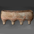
Cooking may have included boiling, pickling, drying, and fermenting, and surplus grain was stored in large terracotta jars. (Figure 15 image of Harappan jars in CSMVS)
Both sea and freshwater fish were probably part of the Harappan diet. Fishhooks discovered at Mohenjo-daro, Chanhu-daro and Harappa are 1–10 cm long, the longest ones were likely for trapping large fish. Hooks were mostly barbed, but barbless hooks have also been found.
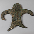
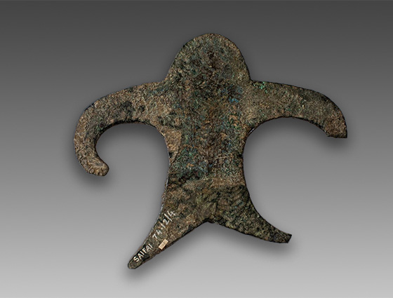
Spearheads made of copper were perhaps used as hunting weapons for game animals and birds. They often had a leaf-shaped blade with a tang for attaching to a wooden shaft. The bronze sculpture of a spear thrower (or perhaps a dancer?) from Chanhu-daro (Figure 16 Image of dancer/spear thrower?) indicates how spears were thrown at targets. Sling balls, made of terracotta but also of stone, shell, and faience, have been found in various sizes, with the smaller ones likely used as projectiles to scare animals or birds from fields and perhaps also in combat.
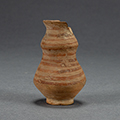
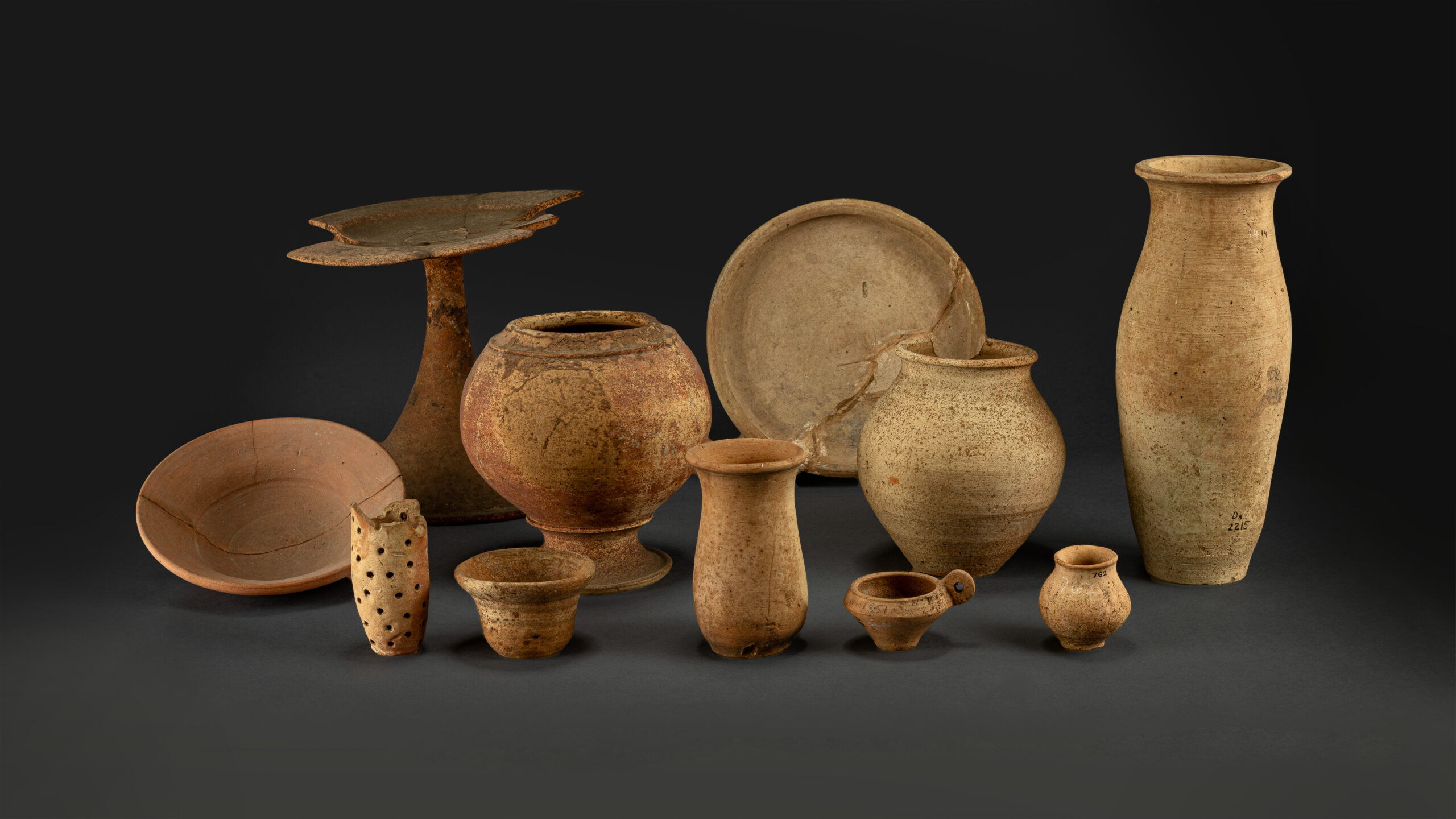
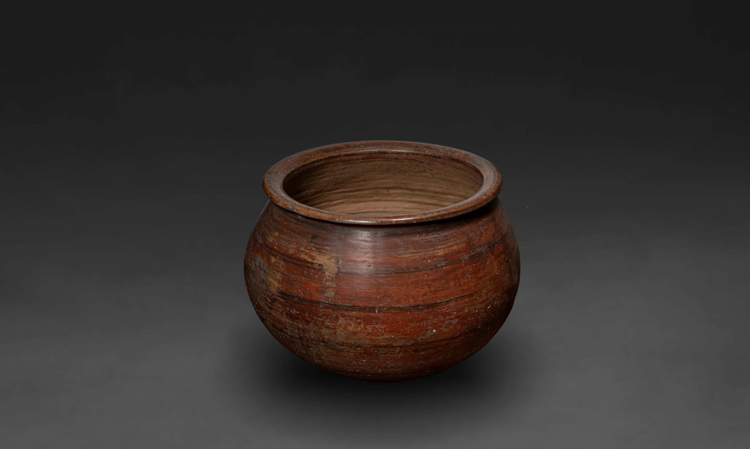
Harappan Pottery
The Harappans began making clay pots as early as 3700 BCE, laying the foundations for ceramic traditions that endured for millennia. Early pottery was almost certainly inspired by basketry, which fishing communities commonly used.
The advent of the potter’s wheel revolutionised the craft, enabling mass production and the formation of potters’ guilds, often with defined gender roles. Jonathan Mark Kenoyer suggests that women were frequently involved in decorating and painting the pottery and ceramic traditions mirrored social and economic choices. A collection of painted shards from the CSMVS show that pottery was enhanced with colour, pattern, and incising (Figure 20 image of pot sherds from CSMVS). The frugal Harappan burials did include pottery, likely intended to provide sustenance for the afterlife.
Pots, their design and form, were not static; they evolved to meet the changing needs of the people. Even after the decline of the Harappan Civilisation, painted pottery persisted in smaller, surviving settlements. Two painted dishes from Cemetery H in Harappa, for example, mark the continuity of pottery traditions after the Bronze Age.
What did the Harappans cities create
Artisans of the Harappan Civilisation invented and mastered new technologies to fabricate extraordinary objects out of ordinary materials that reflected the refined tastes of their owners.
One of the key aspects of Harappan craft was this ability of Harappan craftsmen to turn ordinary raw materials such as stone, shell and clay into extremely sophisticated finished products through complex, precision techniques.
Pottery, metal crafts, weaving and perhaps dyeing of textiles, jewellery, shell work, sculpting animal and human figures, toys and intricately carved seals were the significant crafts of the Harappans. Specialised crafts included stoneware bangles, and bead making that included the drilling and polishing of various kinds of stones. Making kilns, firing bricks, and crafting large boats, and water vessels for long distance travel were also mastered by the Harappans. They were also skilled in working with copper, bronze, gold and silver.
It is likely that raw materials for all objects were partially processed in small towns near their source locations and then brought into larger urban centres for assembly into finished products. This probably allowed wealthy merchant groups to control the production and distribution of such items, thereby asserting their status in society.
How the cities traded
The Harappans engaged in both short and long-distance trade conducted through the sea and land. Standardised weights and measures, seals, depictions of boats, ships, and bullock carts, and craft production centres collectively indicate the existence of an extensive and well-established trade network.
Knowledge of the direction of the monsoon winds facilitated the swift passage of ships from the western shores (in modern Gujarat) further westwards, towards the Gulf of Oman. Trading communities migrated to, and established settlements in the regions of modern-day Oman and Bahrain (known as the lands of Magan and Dilmun in ancient times), spreading craft techniques and cultural ideologies in the process. The trade route extended further from here to Mesopotamia. A trading outpost at Shahr-i-Sokhta in northern Afghanistan facilitated commercial interactions with Central Asian societies.
Trade goods included a diverse range of materials — grains, metals, semi-precious stones, textiles, shells, wood, and oil. Long, cylindrical carnelian beads, used to make necklaces, belts, and headbands, were exported to Mesopotamia via the port of Oman. Surkotada and Lothal (in Gujarat) were likely centres of cotton production, and the extensive dockyard unearthed at Lothal served as a harbour for large trading vessels.
After the Decline of the Harappan Civilisation - c. 1900 - 1000 BCE
As the Harappan Civilisation declined, regional cultures like Jhukar, Cemetery H, Ochre Coloured Pottery, Copper Hoard, Jorwe, and Red-Black Ware emerged. Early Vedic traditions likely began forming. Though urban features vanished, pottery, copper and iron tools, and ornaments continued with similar techniques. Agriculture and belief systems remained largely unchanged. This transitional phase laid the groundwork for future Indian empires.